
Cuban scientists use new technique to study sea bottoms
especiales
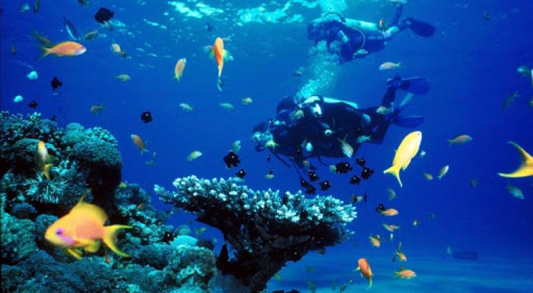
Experts in preservation and care of the environment are studying the coral reefs using 3D photogrammetry off the north coast of western Matanzas province, it was reported.
That technique provides information to biologists and other experts on the size and spatial distribution, in addition to being effective to monitor the behavior of corals and the diseases that attack them.
Esteban Grau, from the Antonio Nuñez Jimenez Foundation for Nature and Man, explained that the team of experts created a 1,100-square-meter baseline at a depth of eight meters.
The zone is in the Faro de Maya protected area and its marine sector is called El Coral, near the city of Matanzas, 100 kilometers east of Havana.
Grau noted that the project 'can be implemented in Cuba's marine protected areas and paves the way to use this technology in the underwater world.'
Used in Cuba since 2017, photogrammetry is associated to archeology and speleology, and the tests that have been done in marine areas in Matanzas are based on that experience.
Due to its geographic location between the coast and the open sea, the coral reefs are barriers that protect the mangroves and prairies of marine grass from the waves.


Add new comment