Ancient Peruvian Mystery Solved From Space
especiales

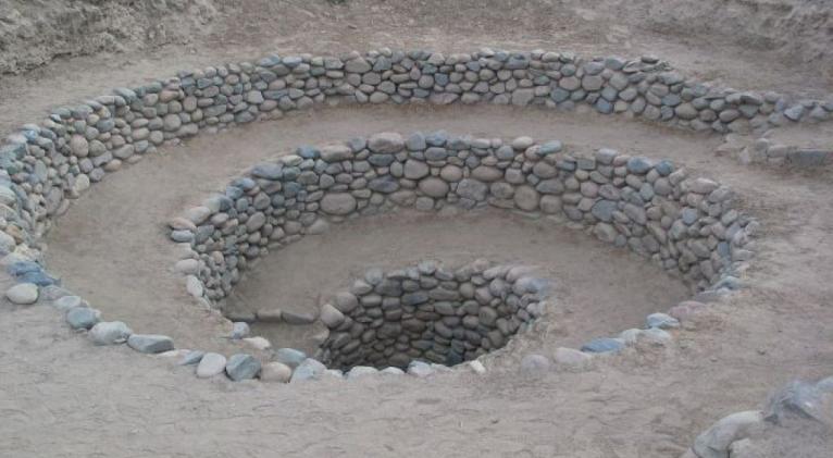
The desert area of Nazca is most famous for giant representations of humans, animals and plants — as well as 900 geometric shapes — carved into the ground: the so-called Nazca lines. But the lines are not the only artifacts of the Nazca civilization, which flourished in the area between 200 BC and 600 AD. The region also contains spiraling, rock-lined holes, known as puquios. Long understood to be a series of underground aqueducts, little else is known about them.
But now, Rosa Lasaponara and a team from the Institute of Methodologies for Environmental Analysis in Italy believe they have some answers. Using satellite imagery, they were able to better understand how the puquios were distributed across the Nazca region.
Peru’s Nazca Lines Reveal Mysterious New Animal Images
By considering their positioning relative to water resources and to settlements, they were able to piece together a picture of just how extraordinarily advanced the puquio system was. The corkscrew-shaped tunnels, Lasaponara concluded, funneled wind into a series of underground canals, forcing water to places in the arid region where it was needed.
“The puquios were the most ambitious hydraulic project in the Nasca area and made water available for the whole year, not only for agriculture and irrigation but also for domestic needs,” she told the BBC. “Exploiting an inexhaustible water supply throughout the year, the puquio system contributed to an intensive agriculture of the valleys in one of the most arid places in the world.”
The puquios’ construction, added Lasaponara, “involved the use of particularly specialized technology,” and their maintenance “was likely based on a collaborative and socially organized system, similar to that adopted for the construction of the famous ’Nazca lines‘ which in some cases are clearly related to the presence of water.”
New Nazca Lines Found in Peruvian Desert
Indeed, one recent theory posits that the lines are in effect a map, pointing to puquios’ locations. As much attention as the lines have deservedly received worldwide over the decades, perhaps it is the puquios that made those lines, and indeed the Nazca civilization, possible.


Add new comment